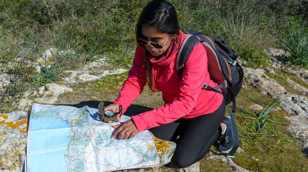
On a recent backpacking trip into the wilderness, I quickly realized a few others in my group lacked confidence with their navigational skills. the further we hiked away from civilization and into the backcountry, the more uneasy they became. It was while we discussed map legends and the upcoming geographical features we would soon encounter that I realized this group was unfamiliar with some of the basics of map reading.
Map reading has become a lost art. Advances in our hand-held technology have replaced this once necessary skill. With modern advances of smart phone technology, apps such as Google Maps and Waze make it ultra convenient to navigate around your community, across town, or cross-country, which has undoubtedly taken the place of using a paper map. Take a trip off the beaten path and you will notice the bars on your cell phone dropping quickly, as you begin to lose cell service and will soon see the dreaded words appear: NO SERVICE.
All too often we heavily rely upon the ease of our navigation features on our phones, iPads, and even turn-by-turn GPS directions most vehicles are equipped with today. But what happens when we lose cellular service and are no longer able to connect to the cell towers above? How are we supposed to find our way without getting lost?
If you are one to venture off the pavement and spend time hiking, backpacking or exploring new areas—do you do your research ahead of a trip to find a map of the area you will be traveling? Do you study the terrain and geographical features where you will be headed?
Simply put, a map is a two-dimensional representation of our three-dimensional world. All maps will have some basic features in common and map reading is all about learning to understand their particular "language.” There are several different kinds of maps today, including Area Maps, Aeronautical Maps, Road Maps, Specialty Maps, and Topographical Maps. Perhaps the most useful map for traveling off grid is a topographic map.
In the United States, topographic maps have been a signature product of the U. S. Geological Survey (USGS) since 1879, when the USGS was entrusted with mapping the nation. A topographic map uses markings such as contour lines to simulate the three-dimensional topography of the land on a two-dimensional map. Contour lines are a method of depicting the 3-dimensional makeup of the terrain on a 2-dimensional map. Contour lines drawn on the map represent equal points of height above sea level. These lines represent the height and shape of various terrain including mountains, slopes, and natural features like bodies of water.
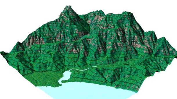
A 3-D side view of a mountain showing how contour lines relate to height
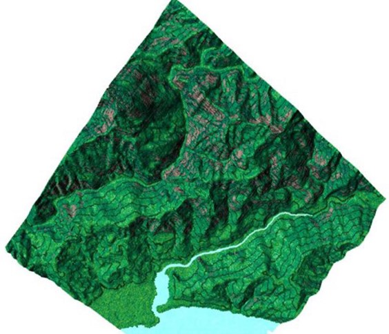
A 3-D top view of a mountain showing contour lines
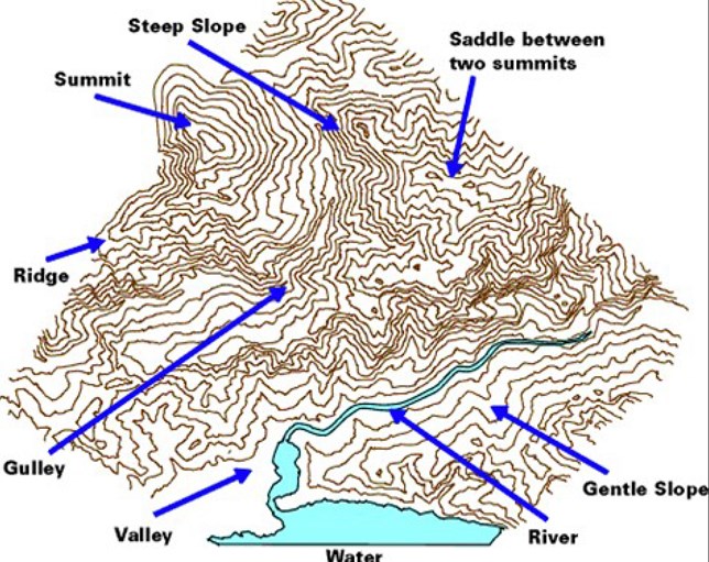
Depressions—indicated by circular contour with lines radiating to the center
Gentle slopes—contours are spread apart
Gully—contours in a U-shape will indicate rounded gullies or trenches
Ridges—contours form a V-shape pointing down the hill
Steep slopes—contours are closely spaced
Summits—contours form circles
Valleys—contours form a V-shape pointing up the hill; these V's are always an indication of a drainage path which could also be a stream or river
Maps are drawn based on latitude and longitude lines. Latitude lines run east and west and measure the distance in degrees north or south from the equator (0° latitude; divides the Northern and Southern hemispheres of the Earth). Longitude lines run north and south intersecting at the geographic poles. Longitude lines measure the distance in degrees east and west from the Prime Meridian and runs through Greenwich, England (0° longitude; divides the Eastern and Western hemispheres of the Earth). The grid created by latitude and longitude lines allows us to calculate an exact point using these lines as X-axis and Y-axis coordinates. Both latitude and longitude are measured in degrees (°).
1° = 60 minutes (‘)
1 minute = 60 seconds (“)
All maps will list their scales in the margin or legend. A scale of 1:25,000 means that 1 unit on the map is the equivalent of 25,000 units in the real world. So, 1-inch measured on the map would be the equivalent of 25,000 inches (2083 feet or about 0. 4 miles) in the real world. Most USGS maps are 1:24,000, also known as 7. 5-minute quadrangles. This means that there is 7. 5 minutes of latitude and 7. 5 minutes of longitude on each side of the map. USGS 7. 5-minute topographic maps cover the lower 48 states and Hawaii.
|
Map Size |
Scale |
Covers |
Map to Landscape |
Metric |
|
7 ½ minute |
1:24,000 |
1/8 of a degree |
1 inch = 2,000 feet (3/8 mile) |
(1 centimeter = 240 meters) |
|
15 minute |
1:62,500 |
1/4 of a degree |
1 inch = ~1 mile
|
(1 centimeter = 625 meters)
|
Learning to read a topographical map is essential to anticipate navigation across terrain safely. Being able to read contour lines, elevation changes, slopes and valleys will aid in preparing for an outdoor adventure, especially when navigating through unfamiliar territory. Routes can be planned, travel times can be estimated, and potential hazards can be identified such as cliffs or rivers. Understanding a topo map will help determine how difficult a route will be, and will enable you to make a decision to ensure personal safety while outdoors. In case of an emergency, knowledge of a topo map can help you communicate your location more quickly and accurately.
Becoming proficient in reading topo maps will increase confidence and awareness when exploring the great outdoors. Visit USGS.gov to create custom topographic maps and access free downloads to help plan your adventures.